
Wawa Dam topographic map
Interactive map
Click on the map to display elevation.
About this map
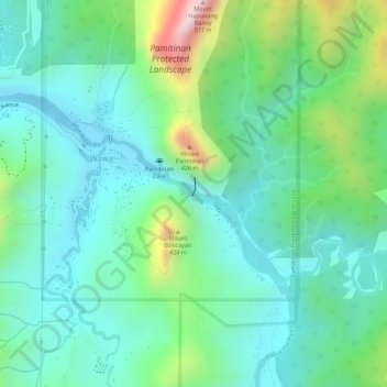
Name: Wawa Dam topographic map, elevation, terrain.
Location: Wawa Dam, Antipolo, Rizal, Calabarzon, 1870, Philippines (14.72776 121.19164 14.72786 121.19174)
Average elevation: 154 m
Minimum elevation: 27 m
Maximum elevation: 480 m
Other topographic maps
Click on a map to view its topography, its elevation and its terrain.