Geolocate

Mandaluyong topographic map

Click on the map to display elevation.

Mandaluyong

Another claims that the Spaniards named the place based on the report of a navigator named Acapulco, who saw the rolling hills frequently being lashed at by daluyong (“big waves from the sea”). This seems to confirm traditional pre-Hispanic stories that giant waves from the sea would meet the adjoining hills of the vast lowland, referred to as salpukan ng alon. Felix dela Huerta, a Franciscan historian, observed that the rolling topography of this land resembled giant waves of the sea.

Wikipedia (CC-BY-SA 3.0)

About this map

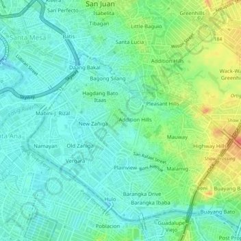
Name: Mandaluyong topographic map, elevation, terrain.

Location: Mandaluyong, Eastern Manila District, Metro Manila, Philippines (14.56721 121.01707 14.60170 121.06006)

Average elevation: 17 m

Minimum elevation: 0 m

Maximum elevation: 56 m

Other topographic maps

Click on a map to view its topography, its elevation and its terrain.

Baguio

Philippines

In 1903, Filipinos, Japanese and Chinese workers were hired to build Kennon Road, the first road directly connecting Baguio with the lowlands of La Union and Pangasinan. Before this, the only road to Benguet was Naguilian Road, and it was largely a horse trail at higher elevations. Camp John Hay was…

Average elevation: 881 m

Quezon City

Philippines

Founded as a pueblo by Saint Pedro Bautista in 1590, San Francisco del Monte may be considered Quezon City's oldest district. The original land area of the old town of San Francisco del Monte was approximately2.5 square kilometres (1.0 sq mi) and covered parts of what is currently known as Project 7 and 8 and…

Average elevation: 57 m

Balsik

Philippines > Bataan > Hermosa

Average elevation: 9 m

Vigan

Philippines > Ilocos Sur

Vigan is situated in a Quaternary Age sedimentary plain called the Vigan-Bantay Plain which is part of the Ilocos coastal plain. The Vigan-Bantay Plain is bounded on the east by a moderately rugged Miocene sediments consisting of interbedded sandstones and shale to very rugged Meta-volcanics and Meta sediment…

Average elevation: 63 m

Antipolo

Philippines > Rizal

Its higher elevation than that of Metro Manila affords it a scenic view of the metropolis, especially at night. Its locally grown mangoes and cashews are popular among tourists, as well as suman – a local delicacy made out of glutinous rice. The Hinulugang Taktak National Park, which was once a popular…

Average elevation: 125 m

Silay

Philippines > Negros Occidental

Average elevation: 44 m

Mines View

Philippines

Average elevation: 1,431 m

Bohol

Philippines

Average elevation: 116 m

Bacolod

Philippines

Bacólod (English: Bacolod), is derived from bakólod (Old Spelling: bacólod), the Old Hiligaynon (Old Ilonggo) (Old Spelling: Ylongo and Ilongo) word for a "hill, turtle, mound, rise, hillock, down, any small eminence or elevation", since the resettlement was founded on a stony, hilly area, now the barangay…

Average elevation: 49 m

Guiguinto

Philippines > Bulacan

Average elevation: 5 m

Binangonan

Philippines > Rizal

Average elevation: 21 m

Tarlac

Philippines

Average elevation: 109 m

Parañaque

Philippines

Average elevation: 14 m

Valenzuela

Philippines

The highest elevation point is 38 meters (125 ft) above sea level. Having a surface gradient of 0.55% and a gentle slope, hilly landscape is located in the industrial section of the city in Canumay. The average elevation point is 2 meters (6.6 ft) above sea level.

Average elevation: 24 m

Mount Banahaw

Philippines > Quezon > Tayabas

The andesitic Banahaw volcanic complex is composed of several stratovolcanoes with Mount Banahaw, the largest with a maximum elevation of 2,170 metres (7,119 ft) above mean sea level. The summit is topped by a 1.5 by 3.5 kilometres (0.93 mi × 2.17 mi) and 210 metres (690 ft) deep crater that is breached on…

Average elevation: 1,730 m

Alfonso

Philippines > Cavite > Alfonso

Average elevation: 413 m

San Juan

Philippines

"San Juan" is a contraction of the city's traditional name of "San Juan del Monte" (lit. 'Saint John of the Mountain'). As with numerous other places in the Philippines, the name combines a patron saint and a toponym; in this case Saint John the Baptist with the locale's hilly terrain and relatively higher…

Average elevation: 35 m

Aritao

Philippines > Nueva Vizcaya

Average elevation: 467 m

Buhatan

Philippines > Sorsogon > Sorsogon City

Average elevation: 18 m

Tanauan

Philippines > Batangas

Average elevation: 164 m

Zamboanga del Sur

Philippines

Average elevation: 118 m

Sariaya

Philippines > Quezon > Sariaya

Average elevation: 210 m

Ligao

Philippines > Albay

Average elevation: 191 m

Baras

Philippines > Rizal

Average elevation: 46 m

Butuan

Philippines

Average elevation: 115 m

Cauayan

Philippines > Isabela

Average elevation: 63 m

Loon

Philippines > Bohol

Loon is composed of land mass, coastlines and natural waters and has a relatively rolling topography consisting of moderate hills, rolling plains, sparse plateaus interspersed with valleys, and some ravines.

Average elevation: 84 m

Bubong

Philippines > Lanao del Sur

Average elevation: 754 m

Jaen

Philippines > Nueva Ecija

Average elevation: 20 m

Mainit

Philippines > Surigao Del Norte

Average elevation: 82 m

Ballesteros

Philippines > Cagayan

Average elevation: 3 m

Mount Matunog

Philippines > Bohol

Average elevation: 696 m

Catbalogan

Philippines > Samar

Average elevation: 60 m

Batanes

Philippines

Average elevation: 26 m

Nueva Ecija

Philippines

Average elevation: 112 m

Balo-i

Philippines > Lanao del Norte

Average elevation: 390 m

Besao

Philippines > Mountain Province

Average elevation: 1,402 m

Rizal

Philippines

Average elevation: 95 m

Tabaco

Philippines > Albay

The City of Tabaco is located on the eastern coast of Albay province with an area of 117.14 km2 (45.23 sq mi). The terrain in the poblacion or town center of Tabaco is generally flat with the highest elevation at around 5 m (16 ft). The northwestern portion reaches 400 m (1,300 ft) above sea level. The city's…

Average elevation: 182 m

Silang

Philippines > Cavite > Silang

Average elevation: 305 m

Cagayan River

Philippines > Quirino

Average elevation: 443 m

Gumaca

Philippines > Quezon

Average elevation: 34 m

Calinog

Philippines > Iloilo

Average elevation: 75 m

Tagaytay

Philippines > Cavite

The southern and eastern portions of Tagaytay are covered by hills and mountains which is generally forests, pine trees and open grasslands. The city lies along Tagaytay Ridge, a ridge stretching about 32 kilometres (20 mi) from Mount Batulao in the west to Mount Sungay in the east with elevations averaging…

Average elevation: 229 m

Tagum

Philippines > Davao del Norte

One of the significant accomplishments of the officialdom of Tagum during the 1990s was its elevation from a second to the first-class municipality. This opened a gateway to increase its financial resources through the Internal Revenue Allocation (IRA) from the national government and local revenues. This was…

Average elevation: 103 m

Pasay

Philippines

Average elevation: 14 m

Malolos

Philippines > Bulacan

Malolos is relatively flat of about 0.81% to a gently sloping of 2.17%. The slope of the land descends towards west, southwest to southern direction. The highest land elevation is at about 6.0 meters above sea level while the lowest is only half a meter below sea level. A network of natural waterways and…

Average elevation: 6 m

Cebu City

Philippines > Cebu > Cebu City

Average elevation: 140 m

Incarizan

Philippines > Sorsogon

Average elevation: 74 m

Patag Island

Philippines

Average elevation: 0 m

Kota Island

Philippines

Average elevation: 0 m

Lankiam Cay

Philippines

Average elevation: 0 m

Iriga

Philippines

Average elevation: 115 m

Davao Gulf

Philippines

Average elevation: 0 m

Lawak Island

Philippines

Average elevation: 0 m

Palanan

Philippines > Isabela

Average elevation: 45 m

Surigao del Sur

Philippines

Average elevation: 274 m

Candaba

Philippines

Average elevation: 6 m

Davao City

Philippines

Average elevation: 65 m

Kinatihan II

Philippines

Average elevation: 22 m

Ibabang Bukal

Philippines

Average elevation: 254 m

Cabatang

Philippines

Average elevation: 335 m

Pinget

Philippines

Average elevation: 1,430 m

Caloocan

Philippines

Average elevation: 81 m

Aurora Hill North Central

Philippines

Average elevation: 1,479 m

Baracatan

Philippines

Average elevation: 357 m

Besigan

Philippines

Average elevation: 584 m

Talomo River

Philippines

Average elevation: 201 m

Asin

Philippines

Average elevation: 1,321 m

Catambungan

Philippines

Average elevation: 5 m

Tablas Strait

Philippines

Average elevation: 0 m

Buenavista

Philippines

Average elevation: 112 m

Poliwes

Philippines

Average elevation: 1,397 m

Teodora Alonzo

Philippines

Average elevation: 1,459 m

Manggahan

Philippines

Average elevation: 7 m

Bakakeng Norte

Philippines

Average elevation: 1,379 m

New Carmen

Philippines

Average elevation: 98 m

Crossing Bayabas

Philippines

Average elevation: 22 m

Taguig

Philippines

Average elevation: 39 m

Marinduque

Philippines

Average elevation: 54 m

Bakakeng Central

Philippines

Average elevation: 1,412 m

Pasig

Philippines

Average elevation: 46 m

Pacdal

Philippines

Average elevation: 1,448 m

Macasandig

Philippines

Average elevation: 42 m

Nueva Vizcaya

Philippines

Average elevation: 107 m

Antique

Philippines

Average elevation: 46 m

Cebu

Philippines

Average elevation: 89 m

Zone IV

Philippines

Average elevation: 4 m

Albay

Philippines

Average elevation: 48 m

Sorsogon

Philippines

Average elevation: 40 m

Camarines Sur

Philippines

Average elevation: 56 m

Samar

Philippines

Average elevation: 38 m

Masbate

Philippines

Average elevation: 54 m

Bulacan

Philippines

Average elevation: 105 m

City Camp Proper

Philippines

Average elevation: 1,430 m

Palawan

Philippines

Average elevation: 9 m

Leyte

Philippines

Average elevation: 54 m

Quirino

Philippines

Average elevation: 108 m