
Thank you for supporting this site ❤️
Make a donation
Make a donation
Mariscal Benavides topographic map
Click on the map to display elevation.
Thank you for supporting this site ❤️
Make a donation
Make a donation
About this map
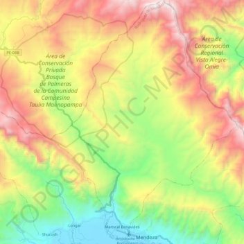
Name: Mariscal Benavides topographic map, elevation, terrain.
Location: Mariscal Benavides, Rodríguez de Mendoza, Amazonas, Perú (-6.40186 -77.56788 -6.18646 -77.40187)
Average elevation: 2,423 m
Minimum elevation: 1,555 m
Maximum elevation: 3,563 m
Thank you for supporting this site ❤️
Make a donation
Make a donation
Other topographic maps
Click on a map to view its topography, its elevation and its terrain.