
Thank you for supporting this site ❤️
Make a donation
Make a donation
Holme Moss topographic map
Click on the map to display elevation.
Thank you for supporting this site ❤️
Make a donation
Make a donation
About this map
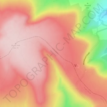
Name: Holme Moss topographic map, elevation, terrain.
Average elevation: 498 m
Minimum elevation: 298 m
Maximum elevation: 581 m
Thank you for supporting this site ❤️
Make a donation
Make a donation
Other topographic maps
Click on a map to view its topography, its elevation and its terrain.
Crowden Great Brook
United Kingdom > England > Derbyshire > High Peak > Tintwistle > Crowden
Average elevation: 314 m
Crowden Great Brook
United Kingdom > England > Derbyshire > High Peak > Tintwistle
Average elevation: 459 m