
Thank you for supporting this site ❤️
Make a donation
Make a donation
Portsmouth topographic map
Click on the map to display elevation.
Thank you for supporting this site ❤️
Make a donation
Make a donation
About this map
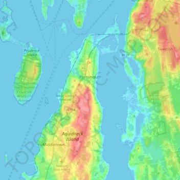
Name: Portsmouth topographic map, elevation, terrain.
Location: Portsmouth, Newport County, Rhode Island, United States (41.51563 -71.37305 41.66686 -71.21392)
Average elevation: 19 m
Minimum elevation: -4 m
Maximum elevation: 93 m
Thank you for supporting this site ❤️
Make a donation
Make a donation