
Thank you for supporting this site ❤️
Make a donation
Make a donation
Kovil topographic map
Click on the map to display elevation.
Thank you for supporting this site ❤️
Make a donation
Make a donation
About this map
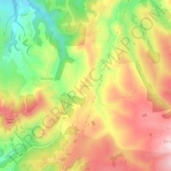
Name: Kovil topographic map, elevation, terrain.
Location: Kovil, Krumovgrad, Kardzhali, 6900, Bulgaria (41.48966 25.64257 41.52966 25.68257)
Average elevation: 377 m
Minimum elevation: 191 m
Maximum elevation: 542 m
Thank you for supporting this site ❤️
Make a donation
Make a donation
Other topographic maps
Click on a map to view its topography, its elevation and its terrain.