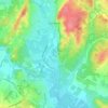
Limousin topographic map
Click on the map to display elevation.
About this map

Name: Limousin topographic map, elevation, terrain.
Location: Limousin, Metropolitan France, France (43.11754 -0.85931 48.31754 4.34069)
Average elevation: 257 m
Minimum elevation: -3 m
Maximum elevation: 1,773 m
Other topographic maps
Click on a map to view its topography, its elevation and its terrain.
Paris
France > Ile-de-France > Paris
Paris in its early history had only the rivers Seine and Bièvre for water. From 1809, the Canal de l'Ourcq provided Paris with water from less-polluted rivers to the north-east of the capital. From 1857, the civil engineer Eugène Belgrand, under Napoleon III, oversaw the construction of a series of new…
Average elevation: 62 m
Paris
France > Ile-de-France > Paris
Paris in its early history had only the rivers Seine and Bièvre for water. From 1809, the Canal de l'Ourcq provided Paris with water from less-polluted rivers to the north-east of the capital. From 1857, the civil engineer Eugène Belgrand, under Napoleon III, oversaw the construction of a series of new…
Average elevation: 62 m
Paris
Paris is situated on a relatively flat terrain, with its average elevation around 150 feet (45 meters) above sea level. The city lies within the Paris Basin, a low-lying area that was shaped over millennia by the meandering River Seine, which cuts through the city. Though generally flat, Paris is home to…
Average elevation: 59 m
Montpellier
Montpellier's highest point is the Place du Peyrou, at an altitude of 57 m (187 ft). The city is built on two hills, Montpellier and Montpelliéret, thus some of its streets have great differences of altitude. Some of its streets are also very narrow and old, which gives it a more intimate feel.
Average elevation: 41 m

Corsica
Under the Köppen climate classification scheme, coastal regions are characterized by a hot-summer Mediterranean climate (Csa). Further inland, a warm-summer Mediterranean climate (Csb) is more common. At the highest elevation locations, small areas with a subarctic climate (Dsc, Dfc) and the rare cold-summer…
Average elevation: 139 m
Brittany
France > Brittany > Landerneau > Loudéac
The Armorican massif reaches its maximal elevation outside of Brittany, in neighbouring Mayenne, at 417 m, and slopes towards the west before straightening on its western extremity, with the Montagnes Noires and the Monts d'Arrée. The highest hill in Brittany is the Roc'h Ruz in the Monts d'Arrée, at 385 m…
Average elevation: 50 m
Chamonix-Mont-Blanc
France > Auvergne-Rhône-Alpes > Upper Savoy
Due to its elevation, Chamonix has a humid continental climate (Dfb, according to the Köppen climate classification), with an average annual precipitation of 1,280 mm (50 in). Summers are mild and winters are cold and snowy.
Average elevation: 2,215 m
Grenoble
France > Auvergne-Rhône-Alpes > Isère
Except for a few dozen houses on the slopes of the Bastille hill of Chartreuse, Grenoble is exclusively built on the alluvial plain of the rivers Isère and Drac at an altitude of 214 metres (702 ft). As a result, the city itself is extremely flat. Mountain sports are an important tourist attraction in summer…
Average elevation: 246 m

Saint-Bonnet-en-Champsaur
France > Provence-Alpes-Côte d'Azur > Hautes-Alpes
Average elevation: 1,216 m

Saint-Clément-sur-Durance
France > Provence-Alpes-Côte d'Azur > Hautes-Alpes
Average elevation: 1,503 m



Annecy
France > Auvergne-Rhône-Alpes > Annecy
Annecy has an oceanic climate (Köppen Cfb) in spite of its relatively far inland position. Influenced by its elevation, summers are rather moderate on average, although they can be highly variable with extreme heat spikes. Winters see occasional freezing temperatures, but most often stays in the single-digits…
Average elevation: 554 m


Maritime Alps
France > Provence-Alpes-Côte d'Azur
Its topography is very mixed. As its name suggests, most of the department is a constituent part of the overall topographic Alps – including the Maritime Alps – but it also has the distinction of being a coastal district with its Mediterranean coast. The coastal area, urbanized and densely populated…
Average elevation: 971 m





Marie-Galante
The island of Marie-Galante is an elevated atoll resting on a rugged limestone substrate, located on the outer arc of the Caribbean plate. A fault called "la Barre" separates the northern quarter from the rest of the island. The north coast, facing Grande-Terre, is characterized by a high cliff, while the…
Average elevation: 52 m




Cirque de Gavarnie
France > Occitania > Hautes Pyrenees > Gavarnie-Gèdre > Gavarnie
Average elevation: 2,364 m




Massif du Luberon
France > Provence-Alpes-Côte d'Azur > Alpes-de-Haute-Provence
The Luberon (French pronunciation: [lyb(ə)ʁɔ̃] or [lybeʁɔ̃]; Provençal: Leberon (classical norm) or Leberoun (Mistralian norm)) is a massif in central Provence in Southern France, part of the French Prealps. It has a maximum elevation of 1,256 metres (4,121 ft) and an area of about 600 square…
Average elevation: 473 m

Hœdic
Hœdic is a low, undulating plateau, 800 metres (2,600 ft) wide by 2,500 metres (8,200 ft) long. Its peak, at an altitude of 22 metres (72 ft), is located in the middle of its eastern part, on the road that leads from the village to the hamlet of the Phare. The island's base consists essentially of granite and…
Average elevation: 1 m