
Thank you for supporting this site ❤️
Make a donation
Make a donation
Khanar topographic map
Click on the map to display elevation.
Thank you for supporting this site ❤️
Make a donation
Make a donation
About this map
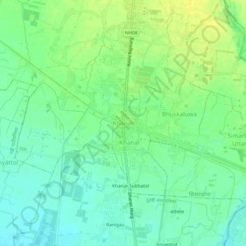
Name: Khanar topographic map, elevation, terrain.
Location: Khanar, Itahari, Sunsari, Koshi Province, 56705, Nepal (26.60374 87.25316 26.64374 87.29316)
Average elevation: 101 m
Minimum elevation: 91 m
Maximum elevation: 111 m
Thank you for supporting this site ❤️
Make a donation
Make a donation