
Thank you for supporting this site ❤️
Make a donation
Make a donation
Mount Piton topographic map
Click on the map to display elevation.
Thank you for supporting this site ❤️
Make a donation
Make a donation
About this map
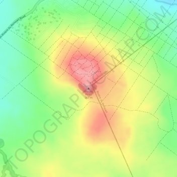
Name: Mount Piton topographic map, elevation, terrain.
Location: Mount Piton, Pamplemousses, 21013, Mauritius (-20.11962 57.62749 -20.11952 57.62759)
Average elevation: 194 m
Minimum elevation: 128 m
Maximum elevation: 262 m
Thank you for supporting this site ❤️
Make a donation
Make a donation
Other topographic maps
Click on a map to view its topography, its elevation and its terrain.