
Thank you for supporting this site ❤️
Make a donation
Make a donation
Senecaville topographic map
Click on the map to display elevation.
Thank you for supporting this site ❤️
Make a donation
Make a donation
About this map
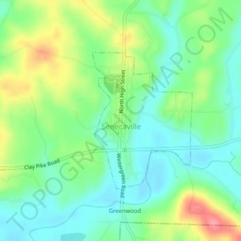
Name: Senecaville topographic map, elevation, terrain.
Location: Senecaville, Guernsey County, Ohio, United States (39.92721 -81.46656 39.94250 -81.45195)
Average elevation: 269 m
Minimum elevation: 239 m
Maximum elevation: 324 m
Thank you for supporting this site ❤️
Make a donation
Make a donation
Other topographic maps
Click on a map to view its topography, its elevation and its terrain.