
Gerhagen topographic map
Interactive map
Click on the map to display elevation.
About this map
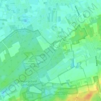
Name: Gerhagen topographic map, elevation, terrain.
Location: Gerhagen, Tessenderlo, Hasselt, Limburg, 3980, België (51.04218 5.02081 51.06218 5.04081)
Average elevation: 24 m
Minimum elevation: 14 m
Maximum elevation: 44 m
Other topographic maps
Click on a map to view its topography, its elevation and its terrain.
Engsbergen
België > Limburg > Hasselt > Tessenderlo
Engsbergen, Tessenderlo, Hasselt, Limburg, Vlaanderen, 3980, België
Average elevation: 25 m
Schoot
België > Limburg > Hasselt > Tessenderlo
Schoot, Tessenderlo, Hasselt, Limburg, 3980, België
Average elevation: 21 m