
Luy topographic map
Interactive map
Click on the map to display elevation.
About this map
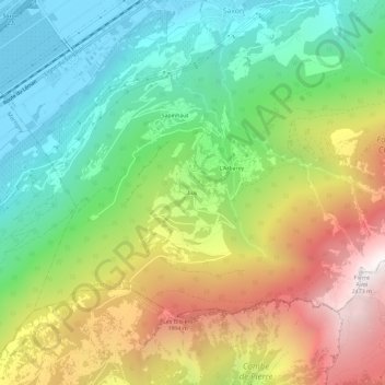
Name: Luy topographic map, elevation, terrain.
Location: Luy, Saxon, Martigny, Valais, 1907, Suisse (46.10636 7.15463 46.14636 7.19463)
Average elevation: 1,241 m
Minimum elevation: 460 m
Maximum elevation: 2,421 m
Other topographic maps
Click on a map to view its topography, its elevation and its terrain.