

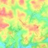
Phoenixville topographic map
Click on the map to display elevation.
About this map

Name: Phoenixville topographic map, elevation, terrain.
Location: Phoenixville, Chester County, Pennsylvania, United States (40.11665 -75.54723 40.16007 -75.49962)
Average elevation: 55 m
Minimum elevation: 21 m
Maximum elevation: 120 m
Other topographic maps
Click on a map to view its topography, its elevation and its terrain.

Valley Forge
United States > Pennsylvania > Chester County > Schuylkill Township
Average elevation: 78 m

Pikeland
United States > Pennsylvania > Chester County > West Pikeland Township > Chester Springs
Average elevation: 107 m

Strafford
United States > Pennsylvania > Chester County > Tredyffrin Township
Average elevation: 133 m
Chester Springs
United States > Pennsylvania > Chester County > West Pikeland Township
Average elevation: 112 m

Longwood Gardens
United States > Pennsylvania > Chester County > East Marlborough Township
Average elevation: 125 m

Nottingham County Park
United States > Pennsylvania > Chester County > West Nottingham Township
Average elevation: 137 m

Rocky Hill
United States > Pennsylvania > Chester County > East Goshen Township > Milltown
Average elevation: 123 m


Landenberg
United States > Pennsylvania > Chester County > New Garden Township
Average elevation: 96 m

Bondsville
United States > Pennsylvania > Chester County > East Brandywine Township
Average elevation: 150 m
Bucktown
United States > Pennsylvania > Chester County > South Coventry Township
Average elevation: 115 m

Woodwards Corner
United States > Pennsylvania > Chester County > West Bradford Township
Average elevation: 143 m
Strickersville
United States > Pennsylvania > Chester County > London Britain Township
Average elevation: 94 m
Nottingham
United States > Pennsylvania > Chester County > West Nottingham Township
Average elevation: 145 m


East Nantmeal
United States > Pennsylvania > Chester County > East Nantmeal Township
Average elevation: 197 m
Freemont
United States > Pennsylvania > Chester County > West Nottingham Township
Average elevation: 115 m
Knickerbocker
United States > Pennsylvania > Chester County > Willistown Township
Average elevation: 127 m

Mount Misery
United States > Pennsylvania > Chester County > Tredyffrin Township
Average elevation: 103 m

Chadds Ford Junction
United States > Pennsylvania > Chester County > Pennsbury Township
Average elevation: 84 m


Brittains Corner
United States > Pennsylvania > Chester County > Schuylkill Township > Valley Forge
Average elevation: 81 m


Waterloo Mills
United States > Pennsylvania > Chester County > Easttown Township
Average elevation: 126 m

Oppermans Corner
United States > Pennsylvania > Chester County > West Pikeland Township > Chester Springs
Average elevation: 126 m

Pomeroy
United States > Pennsylvania > Chester County > Sadsbury Township > Sadsburyville
Average elevation: 175 m
Hayti
United States > Pennsylvania > Chester County > Valley Township
Hayti is a census designated place and unincorporated community situated in Valley Township in Chester County, Pennsylvania, United States. The CDP was first designated as such in 2020. As of 2020, it has a population of 2,890. Hayti has an estimated elevation of 502 feet (153 m) above sea level.
Average elevation: 151 m

Maple Grove
United States > Pennsylvania > Chester County > East Nottingham Township
Average elevation: 136 m
Exton
United States > Pennsylvania > Chester County > West Whiteland Township
Average elevation: 125 m
Valley Forge
United States > Pennsylvania > Chester County > Schuylkill Township
Average elevation: 78 m

Reeceville
United States > Pennsylvania > Chester County > West Brandywine Township
Average elevation: 169 m

Baptism Creek Spring
United States > Pennsylvania > Chester County > North Coventry Township
Average elevation: 228 m

Saint Peters
United States > Pennsylvania > Chester County > Warwick Township
Average elevation: 157 m

Baptist Hill
United States > Pennsylvania > Chester County > Tredyffrin Township
Average elevation: 102 m
Martins Corner
United States > Pennsylvania > Chester County > West Caln Township
Average elevation: 212 m
Grove
United States > Pennsylvania > Chester County > West Whiteland Township
Average elevation: 128 m
Ship Road
United States > Pennsylvania > Chester County > West Whiteland Township > Exton
Average elevation: 133 m

Barnsley
United States > Pennsylvania > Chester County > East Nottingham Township
Average elevation: 155 m
Whitehorse
United States > Pennsylvania > Chester County > Willistown Township
Average elevation: 117 m

Copesville
United States > Pennsylvania > Chester County > East Bradford Township
Average elevation: 92 m