
Thank you for supporting this site ❤️
Make a donation
Make a donation
Kelarik Utara topographic map
Click on the map to display elevation.
Thank you for supporting this site ❤️
Make a donation
Make a donation
About this map
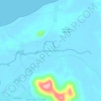
Name: Kelarik Utara topographic map, elevation, terrain.
Location: Kelarik Utara, Natuna, Riau Islands, Sumatra, Indonesia (3.98721 107.99055 4.02721 108.03055)
Average elevation: 11 m
Minimum elevation: 0 m
Maximum elevation: 145 m
Thank you for supporting this site ❤️
Make a donation
Make a donation
Other topographic maps
Click on a map to view its topography, its elevation and its terrain.