
Thank you for supporting this site ❤️
Make a donation
Make a donation
Dhaka Division topographic map
Click on the map to display elevation.
Thank you for supporting this site ❤️
Make a donation
Make a donation
About this map
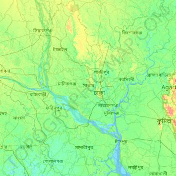
Name: Dhaka Division topographic map, elevation, terrain.
Location: Dhaka Division, Bangladesh (22.84565 89.30123 24.78869 91.24878)
Average elevation: 9 m
Minimum elevation: -2 m
Maximum elevation: 71 m
Thank you for supporting this site ❤️
Make a donation
Make a donation
Other topographic maps
Click on a map to view its topography, its elevation and its terrain.