
Thank you for supporting this site ❤️
Make a donation
Make a donation
Ashby topographic map
Click on the map to display elevation.
Thank you for supporting this site ❤️
Make a donation
Make a donation
About this map
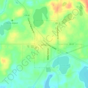
Name: Ashby topographic map, elevation, terrain.
Location: Ashby, Grant County, Minnesota, United States (46.08594 -95.82426 46.10052 -95.80090)
Average elevation: 388 m
Minimum elevation: 368 m
Maximum elevation: 416 m
Thank you for supporting this site ❤️
Make a donation
Make a donation