
Thank you for supporting this site ❤️
Make a donation
Make a donation
Ishim topographic map
Click on the map to display elevation.
Thank you for supporting this site ❤️
Make a donation
Make a donation
About this map
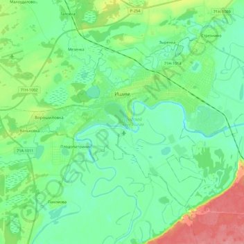
Name: Ishim topographic map, elevation, terrain.
Location: Ishim, Tyumen Oblast, Ural Federal District, Russia (56.05274 69.37101 56.13758 69.59013)
Average elevation: 85 m
Minimum elevation: 64 m
Maximum elevation: 141 m
Thank you for supporting this site ❤️
Make a donation
Make a donation