
Thank you for supporting this site ❤️
Make a donation
Make a donation
Ucayali topographic map
Click on the map to display elevation.
Thank you for supporting this site ❤️
Make a donation
Make a donation
About this map
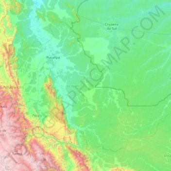
Name: Ucayali topographic map, elevation, terrain.
Location: Ucayali, Peru (-11.44841 -75.94575 -7.26205 -70.49417)
Average elevation: 694 m
Minimum elevation: 115 m
Maximum elevation: 5,617 m
Thank you for supporting this site ❤️
Make a donation
Make a donation
Other topographic maps
Click on a map to view its topography, its elevation and its terrain.