
Гейзер topographic map
Interactive map
Click on the map to display elevation.
About this map
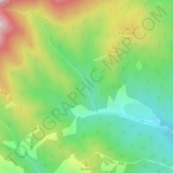
Name: Гейзер topographic map, elevation, terrain.
Average elevation: 388 m
Minimum elevation: 129 m
Maximum elevation: 795 m
Other topographic maps
Click on a map to view its topography, its elevation and its terrain.
Raïon de Bakhtchyssaraï
Russie > District fédéral du Sud
Raïon de Bakhtchyssaraï, District fédéral du Sud, Russie
Average elevation: 404 m