
Thank you for supporting this site ❤️
Make a donation
Make a donation
France topographic map
Click on the map to display elevation.
Thank you for supporting this site ❤️
Make a donation
Make a donation
About this map
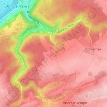
Name: France topographic map, elevation, terrain.
Location: France, Nandrin, Huy, Liège, Wallonie, 4550, Belgique (50.50657 5.33797 50.54657 5.37797)
Average elevation: 202 m
Minimum elevation: 63 m
Maximum elevation: 260 m
Thank you for supporting this site ❤️
Make a donation
Make a donation
Other topographic maps
Click on a map to view its topography, its elevation and its terrain.
Thank you for supporting this site ❤️
Make a donation
Make a donation