
Mellingen topographic map
Interactive map
Click on the map to display elevation.
About this map
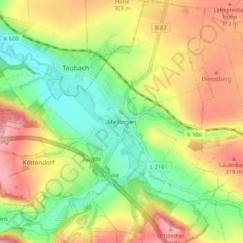
Name: Mellingen topographic map, elevation, terrain.
Location: Mellingen, Landkreis Weimarer Land, Thuringe, Allemagne (50.91810 11.35079 50.96402 11.42422)
Average elevation: 274 m
Minimum elevation: 215 m
Maximum elevation: 339 m