
Attelwil topographic map
Interactive map
Click on the map to display elevation.
About this map
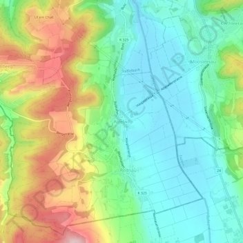
Name: Attelwil topographic map, elevation, terrain.
Location: Attelwil, Reitnau, Bezirk Zofingen, Argovie, 5056, Suisse (47.23933 8.02332 47.27933 8.06332)
Average elevation: 559 m
Minimum elevation: 471 m
Maximum elevation: 722 m