
Thank you for supporting this site ❤️
Make a donation
Make a donation
Osmaneli topographic map
Click on the map to display elevation.
Thank you for supporting this site ❤️
Make a donation
Make a donation
About this map
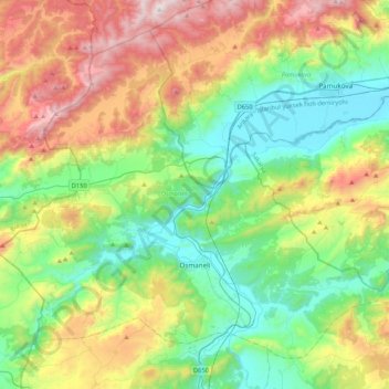
Name: Osmaneli topographic map, elevation, terrain.
Location: Osmaneli, Bilecik, Marmara Region, 11500, Turkey (40.27978 29.79808 40.55137 30.22049)
Average elevation: 497 m
Minimum elevation: 68 m
Maximum elevation: 1,338 m
Thank you for supporting this site ❤️
Make a donation
Make a donation
Other topographic maps
Click on a map to view its topography, its elevation and its terrain.