
Thank you for supporting this site ❤️
Make a donation
Make a donation
Nongwar topographic map
Click on the map to display elevation.
Thank you for supporting this site ❤️
Make a donation
Make a donation
About this map
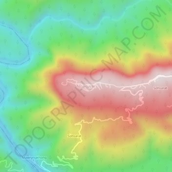
Name: Nongwar topographic map, elevation, terrain.
Location: Nongwar, Shella Bholaganj, East Khasi Hills, Meghalaya, India (25.19788 91.62502 25.23788 91.66502)
Average elevation: 415 m
Minimum elevation: 29 m
Maximum elevation: 919 m
Thank you for supporting this site ❤️
Make a donation
Make a donation
Other topographic maps
Click on a map to view its topography, its elevation and its terrain.