
Thank you for supporting this site ❤️
Make a donation
Make a donation
Ainet topographic map
Click on the map to display elevation.
Thank you for supporting this site ❤️
Make a donation
Make a donation
About this map
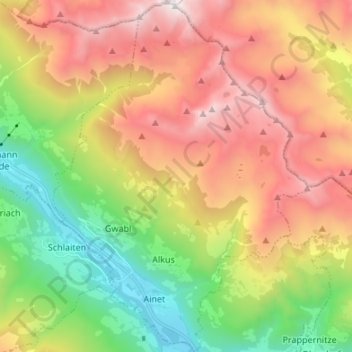
Name: Ainet topographic map, elevation, terrain.
Location: Ainet, Bezirk Lienz, Tyrol, 9951, Austria (46.85217 12.65130 46.94409 12.74866)
Average elevation: 1,811 m
Minimum elevation: 694 m
Maximum elevation: 3,200 m
Thank you for supporting this site ❤️
Make a donation
Make a donation
Other topographic maps
Click on a map to view its topography, its elevation and its terrain.
Thank you for supporting this site ❤️
Make a donation
Make a donation
Salzbodensee
Austria > Tyrol > Bezirk Lienz > Marktgemeinde Matrei in Osttirol
Average elevation: 2,250 m
Bobojach
Austria > Tyrol > Bezirk Lienz > Gemeinde Prägraten am Großvenediger
Average elevation: 1,728 m
Thank you for supporting this site ❤️
Make a donation
Make a donation