
Thank you for supporting this site ❤️
Make a donation
Make a donation
Kishanganj topographic map
Click on the map to display elevation.
Thank you for supporting this site ❤️
Make a donation
Make a donation
About this map
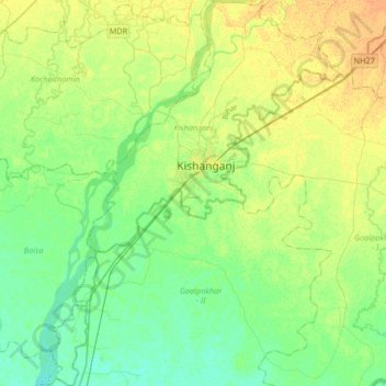
Name: Kishanganj topographic map, elevation, terrain.
Location: Kishanganj, Kishanganj district, Bihar, India (25.93051 87.81550 26.22790 88.06540)
Average elevation: 47 m
Minimum elevation: 37 m
Maximum elevation: 60 m
Thank you for supporting this site ❤️
Make a donation
Make a donation
Other topographic maps
Click on a map to view its topography, its elevation and its terrain.
Thank you for supporting this site ❤️
Make a donation
Make a donation
Thank you for supporting this site ❤️
Make a donation
Make a donation