
Luanshya topographic map
Interactive map
Click on the map to display elevation.
About this map
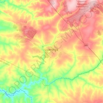
Name: Luanshya topographic map, elevation, terrain.
Location: Luanshya, Luanshya District, Province de Copperbelt, Zambie (-13.29187 28.25752 -12.97187 28.57752)
Average elevation: 1,229 m
Minimum elevation: 1,144 m
Maximum elevation: 1,317 m
Other topographic maps
Click on a map to view its topography, its elevation and its terrain.
Ndola
Zambie > Province de Copperbelt > Ndola
Ndola, Ndola District, Province de Copperbelt, Zambie
Average elevation: 1,287 m