
Thank you for supporting this site ❤️
Make a donation
Make a donation
Pedro topographic map
Click on the map to display elevation.
Thank you for supporting this site ❤️
Make a donation
Make a donation
About this map
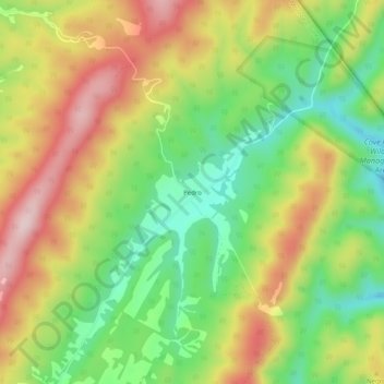
Name: Pedro topographic map, elevation, terrain.
Location: Pedro, Monroe County, West Virginia, 24936, United States (37.64290 -80.33451 37.68290 -80.29451)
Average elevation: 808 m
Minimum elevation: 664 m
Maximum elevation: 975 m
Thank you for supporting this site ❤️
Make a donation
Make a donation
Other topographic maps
Click on a map to view its topography, its elevation and its terrain.