
Cap La Houssaye topographic map
Interactive map
Click on the map to display elevation.
About this map
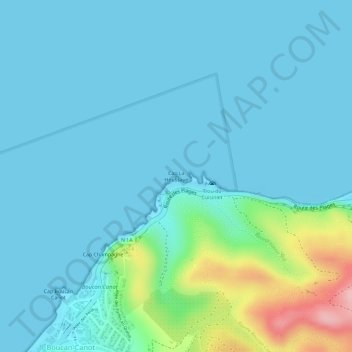
Name: Cap La Houssaye topographic map, elevation, terrain.
Location: Cap La Houssaye, Saint-Paul, La Réunion, 97862, France (-21.01792 55.23519 -21.01782 55.23529)
Average elevation: 26 m
Minimum elevation: 0 m
Maximum elevation: 167 m