
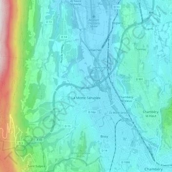
La Motte-Servolex topographic map
Interactive map
Click on the map to display elevation.
About this map
Name: La Motte-Servolex topographic map, elevation, terrain.
Average elevation: 410 m
Minimum elevation: 232 m
Maximum elevation: 1,356 m
Les relevés suivants ont été effectués à l'aéroport de Chambéry - Savoie-Mont-Blanc à 234 m d'altitude.