
Thank you for supporting this site ❤️
Make a donation
Make a donation
Rock Camp topographic map
Click on the map to display elevation.
Thank you for supporting this site ❤️
Make a donation
Make a donation
About this map
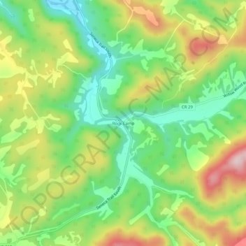
Name: Rock Camp topographic map, elevation, terrain.
Location: Rock Camp, Monroe County, West Virginia, United States (37.47818 -80.62674 37.51818 -80.58674)
Average elevation: 638 m
Minimum elevation: 514 m
Maximum elevation: 811 m
Thank you for supporting this site ❤️
Make a donation
Make a donation
Other topographic maps
Click on a map to view its topography, its elevation and its terrain.