
Thank you for supporting this site ❤️
Make a donation
Make a donation
Wingina topographic map
Click on the map to display elevation.
Thank you for supporting this site ❤️
Make a donation
Make a donation
About this map
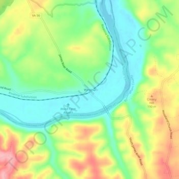
Name: Wingina topographic map, elevation, terrain.
Location: Wingina, Nelson County, Virginia, 24599, United States (37.61987 -78.74390 37.65987 -78.70390)
Average elevation: 148 m
Minimum elevation: 98 m
Maximum elevation: 219 m
Thank you for supporting this site ❤️
Make a donation
Make a donation
Other topographic maps
Click on a map to view its topography, its elevation and its terrain.
Thank you for supporting this site ❤️
Make a donation
Make a donation
Thank you for supporting this site ❤️
Make a donation
Make a donation