
Thank you for supporting this site ❤️
Make a donation
Make a donation
Camerons Mill topographic map
Click on the map to display elevation.
Thank you for supporting this site ❤️
Make a donation
Make a donation
About this map
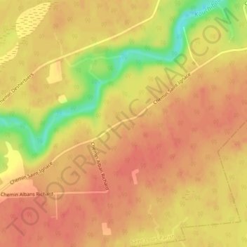
Name: Camerons Mill topographic map, elevation, terrain.
Average elevation: 46 m
Minimum elevation: 6 m
Maximum elevation: 60 m
Thank you for supporting this site ❤️
Make a donation
Make a donation
Other topographic maps
Click on a map to view its topography, its elevation and its terrain.
Wellington Parish
Canada > New Brunswick > Kent County > Town of Grand-Bouctouche
Average elevation: 19 m
Thank you for supporting this site ❤️
Make a donation
Make a donation