
Make a donation
Hilltop topographic map
Click on the map to display elevation.
Make a donation
About this map
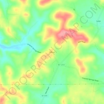
Name: Hilltop topographic map, elevation, terrain.
Location: Hilltop, Grayson County, Kentucky, United States (37.37505 -86.12719 37.41505 -86.08719)
Average elevation: 215 m
Minimum elevation: 170 m
Maximum elevation: 273 m
Make a donation
Other topographic maps
Click on a map to view its topography, its elevation and its terrain.
Rough River Lake
United States > Kentucky > Grayson County
As the seasons change, so does the size of the Rough River Lake. During the summer the lake is about 5,100 acres (2,100 ha), has 220 miles (350 km) of shoreline, is 39 miles long, and is 65 feet (20 m) deep in the deepest portion of the lake, which includes the area around the dam. During the winter the lake…
Average elevation: 183 m
Make a donation