
Thank you for supporting this site ❤️
Make a donation
Make a donation
Plantersville topographic map
Click on the map to display elevation.
Thank you for supporting this site ❤️
Make a donation
Make a donation
About this map
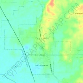
Name: Plantersville topographic map, elevation, terrain.
Location: Plantersville, Lee County, Mississippi, United States (34.19770 -88.68325 34.22636 -88.64141)
Average elevation: 84 m
Minimum elevation: 70 m
Maximum elevation: 112 m
Thank you for supporting this site ❤️
Make a donation
Make a donation
Other topographic maps
Click on a map to view its topography, its elevation and its terrain.