
Thank you for supporting this site ❤️
Make a donation
Make a donation
Sundar topographic map
Click on the map to display elevation.
Thank you for supporting this site ❤️
Make a donation
Make a donation
About this map
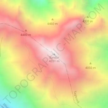
Name: Sundar topographic map, elevation, terrain.
Location: Sundar, Taghring, Marsyangdi, Lamjung, Gandaki Pradesh, Nepal (28.42726 84.32806 28.42736 84.32816)
Average elevation: 3,742 m
Minimum elevation: 2,900 m
Maximum elevation: 4,324 m
Thank you for supporting this site ❤️
Make a donation
Make a donation