
Castelldefels topographic map
Interactive map
Click on the map to display elevation.
About this map
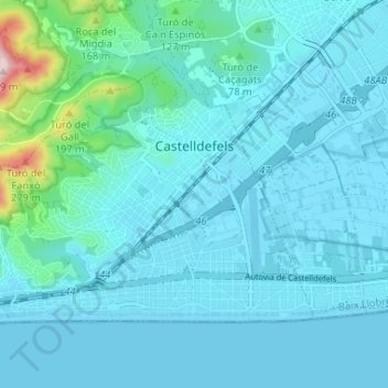
Name: Castelldefels topographic map, elevation, terrain.
Average elevation: 35 m
Minimum elevation: -1 m
Maximum elevation: 351 m
Other topographic maps
Click on a map to view its topography, its elevation and its terrain.
Olesa de Montserrat
Spanien > Katalonien > Baix Llobregat > Olesa de Montserrat > Olesa de Montserrat
Olesa de Montserrat, Baix Llobregat, Barcelona, Katalonien, 08640, Spanien
Average elevation: 216 m