
Thank you for supporting this site ❤️
Make a donation
Make a donation
Ginzling topographic map
Click on the map to display elevation.
Thank you for supporting this site ❤️
Make a donation
Make a donation
About this map
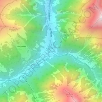
Name: Ginzling topographic map, elevation, terrain.
Location: Ginzling, Mayrhofen, Bezirk Schwaz, Tyrol, 6295, Austria (47.08032 11.78904 47.12032 11.82904)
Average elevation: 1,564 m
Minimum elevation: 917 m
Maximum elevation: 2,710 m
Thank you for supporting this site ❤️
Make a donation
Make a donation