
Taourirte topographic map
Interactive map
Click on the map to display elevation.
About this map
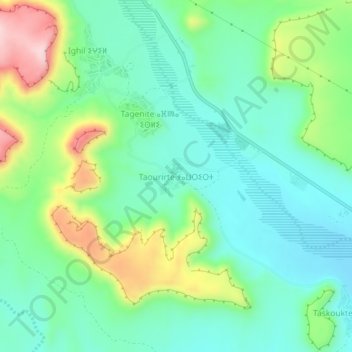
Name: Taourirte topographic map, elevation, terrain.
Average elevation: 1,417 m
Minimum elevation: 1,338 m
Maximum elevation: 1,602 m
Other topographic maps
Click on a map to view its topography, its elevation and its terrain.
Lac Tamda
Maroc > cercle d'Amerzgane > Télouet
Lac Tamda, Télouet, caïdat de Telouet, cercle d'Amerzgane, Province de Ouarzazate, Drâa-Tafilalet, Maroc
Average elevation: 2,823 m