
Thank you for supporting this site ❤️
Make a donation
Make a donation
Puerto Lleras topographic map
Click on the map to display elevation.
Thank you for supporting this site ❤️
Make a donation
Make a donation
About this map
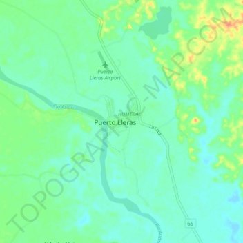
Name: Puerto Lleras topographic map, elevation, terrain.
Location: Puerto Lleras, Meta, Colombia (3.22999 -73.41341 3.30999 -73.33341)
Average elevation: 236 m
Minimum elevation: 224 m
Maximum elevation: 267 m
Thank you for supporting this site ❤️
Make a donation
Make a donation