
Emmorton topographic map
Interactive map
Click on the map to display elevation.
About this map
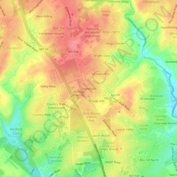
Name: Emmorton topographic map, elevation, terrain.
Location: Emmorton, Harford County, Maryland, 21015, United States (39.47539 -76.34274 39.51539 -76.30274)
Average elevation: 76 m
Minimum elevation: 27 m
Maximum elevation: 115 m