
Noun topographic map
Interactive map
Click on the map to display elevation.
About this map
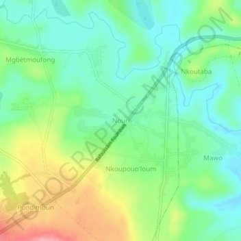
Name: Noun topographic map, elevation, terrain.
Location: Noun, Koutaba, Noun, Région de l'Ouest, Cameroun (5.66478 10.78300 5.70478 10.82300)
Average elevation: 1,163 m
Minimum elevation: 1,122 m
Maximum elevation: 1,239 m