
Thank you for supporting this site ❤️
Make a donation
Make a donation
Kamieskroon topographic map
Click on the map to display elevation.
Thank you for supporting this site ❤️
Make a donation
Make a donation
Kamieskroon
Kamieskroon is a small town in the Kamiesberg Local Municipality, lying in the foothills of the Kamiesberge at an elevation of approximately 800 m (2 600 ft). The town is more or less in the centre of Namaqualand, about 70 km (43 mi) to the south of Springbok, Northern Cape, South Africa. It is known mainly for its abundance of wild flowers during spring.
Thank you for supporting this site ❤️
Make a donation
Make a donation
About this map
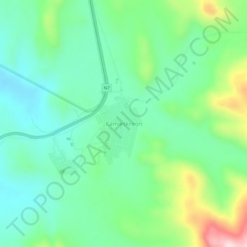
Name: Kamieskroon topographic map, elevation, terrain.
Average elevation: 789 m
Minimum elevation: 676 m
Maximum elevation: 1,071 m
Thank you for supporting this site ❤️
Make a donation
Make a donation