
Cata topographic map
Interactive map
Click on the map to display elevation.
About this map
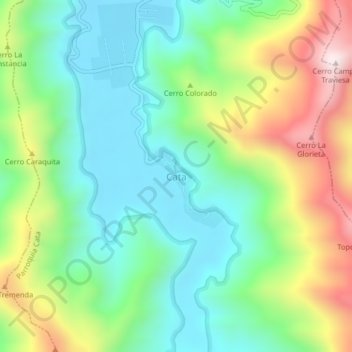
Name: Cata topographic map, elevation, terrain.
Average elevation: 244 m
Minimum elevation: 4 m
Maximum elevation: 720 m
Other topographic maps
Click on a map to view its topography, its elevation and its terrain.
Ciénaga de Ocumare
Venezuela > Estado Aragua > Municipio Ocumare
Ciénaga de Ocumare, Parroquia Ocumare de La Costa, Municipio Ocumare, Estado Aragua, 2112, Venezuela
Average elevation: 112 m