
Auke Lake topographic map
Click on the map to display elevation.
About this map
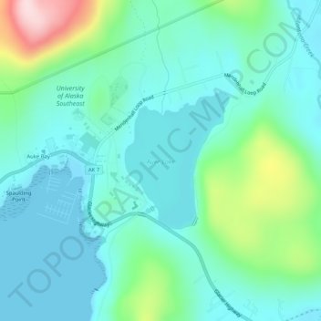
Name: Auke Lake topographic map, elevation, terrain.
Location: Auke Lake, Juneau, Alaska, United States (58.38107 -134.63911 58.39266 -134.62230)
Average elevation: 61 m
Minimum elevation: 0 m
Maximum elevation: 285 m
Other topographic maps
Click on a map to view its topography, its elevation and its terrain.