
Thank you for supporting this site ❤️
Make a donation
Make a donation
Lindenberg im Allgäu topographic map
Click on the map to display elevation.
Thank you for supporting this site ❤️
Make a donation
Make a donation
About this map
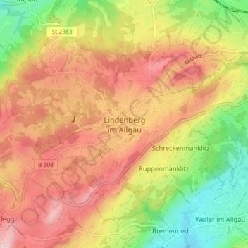
Name: Lindenberg im Allgäu topographic map, elevation, terrain.
Location: Lindenberg im Allgäu, Landkreis Lindau, Bavaria, 88161, Germany (47.58233 9.85888 47.62093 9.93043)
Average elevation: 738 m
Minimum elevation: 599 m
Maximum elevation: 854 m
Thank you for supporting this site ❤️
Make a donation
Make a donation
Other topographic maps
Click on a map to view its topography, its elevation and its terrain.