
Thank you for supporting this site ❤️
Make a donation
Make a donation
Turkey Creek topographic map
Click on the map to display elevation.
Thank you for supporting this site ❤️
Make a donation
Make a donation
About this map
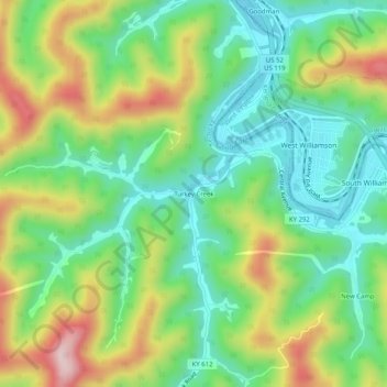
Name: Turkey Creek topographic map, elevation, terrain.
Location: Turkey Creek, Pike County, Kentucky, 41514, United States (37.65093 -82.32709 37.69093 -82.28709)
Average elevation: 312 m
Minimum elevation: 183 m
Maximum elevation: 538 m
Thank you for supporting this site ❤️
Make a donation
Make a donation
Other topographic maps
Click on a map to view its topography, its elevation and its terrain.