
Thank you for supporting this site ❤️
Make a donation
Make a donation
San Andres topographic map
Click on the map to display elevation.
Thank you for supporting this site ❤️
Make a donation
Make a donation
About this map
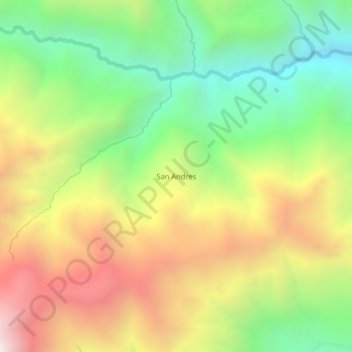
Name: San Andres topographic map, elevation, terrain.
Location: San Andres, Querocotillo, Cutervo, Cajamarca, Perú (-6.21592 -79.13668 -6.17592 -79.09668)
Average elevation: 2,188 m
Minimum elevation: 1,509 m
Maximum elevation: 3,037 m
Thank you for supporting this site ❤️
Make a donation
Make a donation