
Thank you for supporting this site ❤️
Make a donation
Make a donation
Hermosa topographic map
Click on the map to display elevation.
Thank you for supporting this site ❤️
Make a donation
Make a donation
About this map
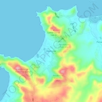
Name: Hermosa topographic map, elevation, terrain.
Location: Hermosa, Sardinal, Carrillo, Guanacaste, 50503, Costa Rica (10.55450 -85.69419 10.59450 -85.65419)
Average elevation: 45 m
Minimum elevation: 0 m
Maximum elevation: 178 m
Thank you for supporting this site ❤️
Make a donation
Make a donation