
Thank you for supporting this site ❤️
Make a donation
Make a donation
Yelanduru topographic map
Click on the map to display elevation.
Thank you for supporting this site ❤️
Make a donation
Make a donation
Yelanduru
Yelandur is located at 12°04′N 77°02′E / 12.07°N 77.03°E / 12.07; 77.03. It has an average elevation of 555 metres (1820 feet). Yalandur is the taluk and city in Chamarajanagar district in Karnataka state of India. It consists of 33 villages. It is situated about 59 km south-west of Mysuru and about 150 km south of Bengaluru on National Highway NH 209. In history it was called Cholendra Simha Chaturvedi Mangala and Yele Induru. Later on, it changed into Yalandur.
Thank you for supporting this site ❤️
Make a donation
Make a donation
About this map
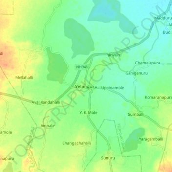
Name: Yelanduru topographic map, elevation, terrain.
Average elevation: 660 m
Minimum elevation: 645 m
Maximum elevation: 681 m
Thank you for supporting this site ❤️
Make a donation
Make a donation